Sections and earthwork
This chapter takes a built corridor to quantities: sample lines across the road, cross-section views, cut and fill volumes, the mass haul diagram and a takeoff by DPWH pay item. You'll be able to make all of them in a few commands, choose the volume method and the embankment factor, read the free haul and overhaul, and print the earthwork, mass haul and quantity reports.
How earthwork works in Terrace
Earthwork starts from sample lines: lines across the alignment at a regular interval, each one cutting a cross section through the existing ground and the corridor. Sample lines belong to a sample line group (listed under Sample Line Groups in the Project browser), and the group does everything else:
- at each line, the area of every material — cut, fill, and each pavement layer;
- between lines, the volume, by average end area or the prismoidal formula, and the running totals;
- the mass haul: how much cut is left over (or missing) at each station, where it balances, and how far the material has to be hauled;
- the quantity takeoff by DPWH pay item.
It can also draw the section views (one small drawing per line), an earthwork volume table and the mass haul diagram. Everything stays linked: move a PVI and the corridor, the sections, the volumes, the diagram and the table all update.
The tools are in the Sections group of the Roads tab and on the command line (see the Roads commands). Each command is one undo step.
The pictures use the sample project (Help ▸ Open the Sample Project), whose group Teresa Bypass Sections has 71 sample lines from Km 35+200 to Km 36+422.77 along the Teresa Bypass Corridor. You need a corridor first: see Typical sections and corridors.
Tip The Next step panel's Compute volumes button opens the Sample Lines dialog when the road has no sample lines yet, and starts COMPUTEVOLUMES after that.
Sample lines
Make the sample lines once the corridor is built. Terrace picks the DPWH cross-section spacing and the right things to sample, so the volumes come out by themselves; the dialog also draws the section views and the mass haul diagram in the same step.
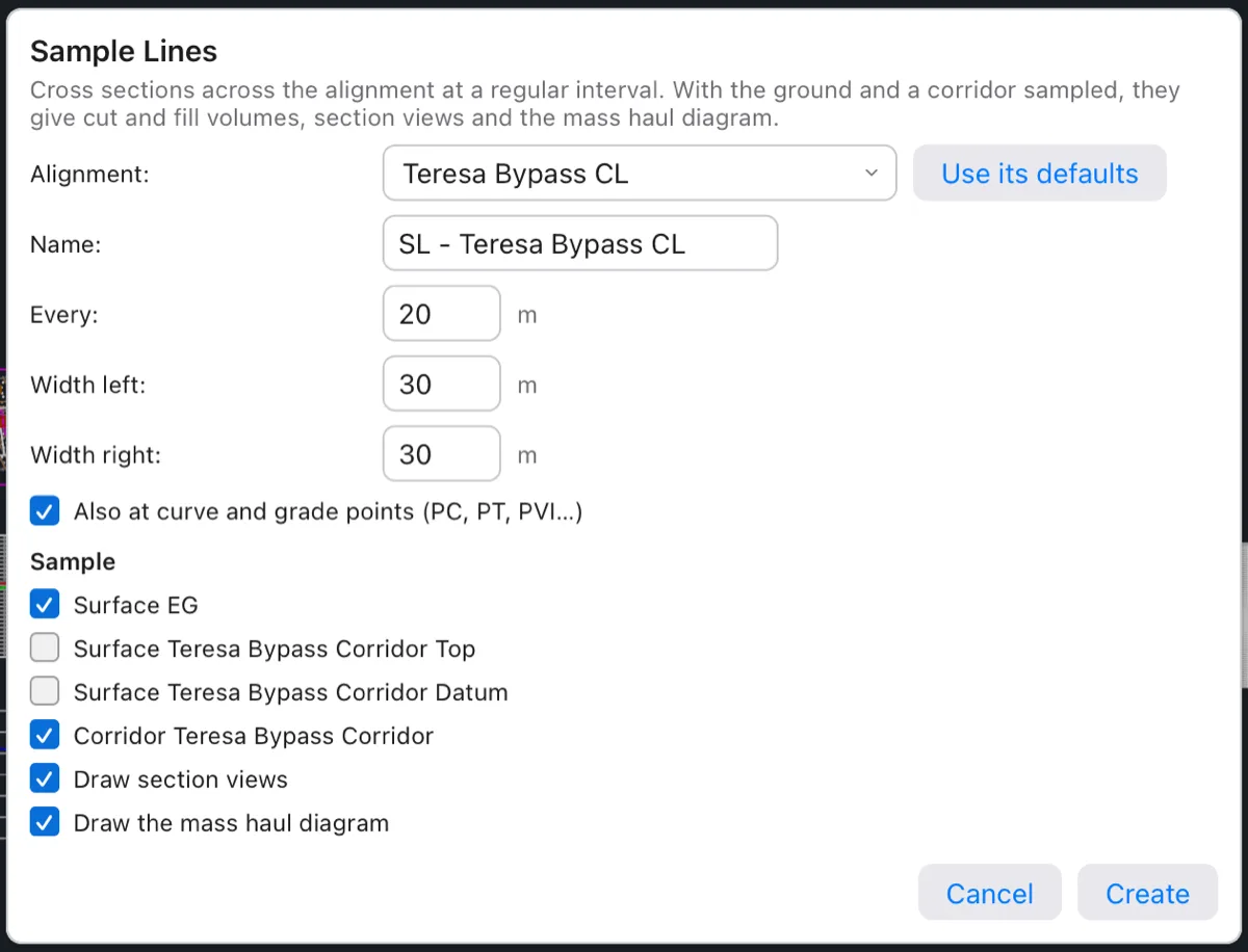
- Click Roads ▸ Sample Lines (also on the Corridor contextual tab, and Compute volumes in Next step). The Sample Lines dialog opens on the selected alignment (or the one the selected profile, profile view or corridor's road belongs to; else the first).
- Check the fields (table below).
- Click Create.
| Field | What it does (default) |
|---|---|
| Alignment | The road to sample. Use its defaults fills every field below again for the alignment you chose (name, widths, which corridors). |
| Name | The group's name: SL - alignment. It must be new. |
| Every | The interval: 20 m, the DPWH cross-section interval (50 ft in US units). |
| Width left, Width right | How far each line reaches from the centerline: 30 m (100 ft). Lines must reach past the daylight points on both sides, or part of the cut and fill is missed — widen them for a road in deep cut or high fill. |
| Also at curve and grade points (PC, PT, PVI…) | Adds a line at every geometry point, so curves and grade breaks are never skipped (on). |
| Sample: Surface … | The surfaces to cut sections through. EG is ticked (or the only surface). |
| Sample: Corridor … | Every corridor built on this alignment, ticked. A corridor is sampled at its Datum (bottom of pavement) when it has one, so earthwork is measured to subgrade. |
| Draw section views | Draws a section view for every line, with the volume table, to the right of everything already drawn (on). |
| Draw the mass haul diagram | Draws the mass haul diagram below everything already drawn (on). |
Terrace makes the lines, computes the volumes and says what it got. On the sample road: Sample lines SL - Teresa Bypass CL: 71 lines; cut 21271, fill 13642 m³.
Create refuses, with a note at the bottom of the dialog, when the name is empty or taken, a number is out of range, or nothing is ticked under Sample.
From the command line
Type SAMPLELINES (SLINES) to make the lines by prompts. The command doesn't draw the views or the diagram; use SECTIONVIEWS and MASSHAUL afterwards.
- Select alignment [Dialog]: Enter for the selected (or latest) alignment, or click one, or type its name. Type D to open the Sample Lines dialog instead.
- Sample line interval: Enter for 20 m (50 ft in US units), or type another.
- Swath width each side: Enter for the default — at least 30 m (100 ft), widened to the corridor's widest point plus 5 m, rounded up to 5 m.

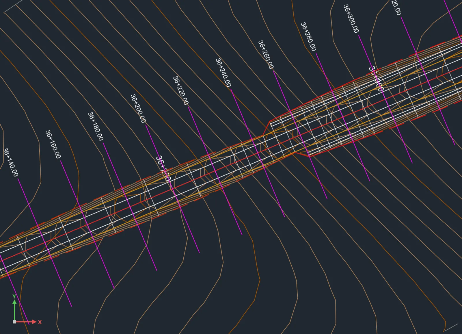
SAMPLELINES on the sample road, every answer the default.What you get, from the dialog or the command:
- A sample line group (the command names it SLG - alignment), with a line every 20 m along the whole alignment, plus a line at every geometry point (TS, SC, CS, ST, PVI…).
- Each line samples the existing ground (the surface called EG or Existing…) and every corridor on the alignment, measured to its datum (the bottom of the pavement).
- The materials, areas and volumes, computed at once.
- The lines in plan on the
C-ROAD-SCTNlayer, each labelled with its station.
Note Earthwork is measured between the ground and the corridor's datum — the bottom of the subbase — so the excavation for the pavement box counts as cut, as DPWH measures roadway excavation to subgrade. The sample project's own group samples the corridor's top instead, which is why its cut (17,985 m³) is smaller than the 21,271 m³ that the Sample Lines dialog and SAMPLELINES give for the same road.
Section views
Section views are the cross sections drawn out, one per sample line, for checking the design and for the cross-section sheets.
- Click Roads ▸ Section Views, or type
SECTIONVIEWS(SVIEWS, orXSECTIONS). - Select sample line group: Enter for the selected (or latest) group, or click one, or type its name.
- Specify where the section views start: click an empty place in the drawing (or type coordinates).
- Section views per column: Enter for 5, or type another number.

The views are laid out in columns, the first station at the point you picked and the stations going up each column (the prompt says "upper-left", but the point is the lower-left corner of the first view). All views share one size: wide enough for the widest swath and tall enough for the tallest section.
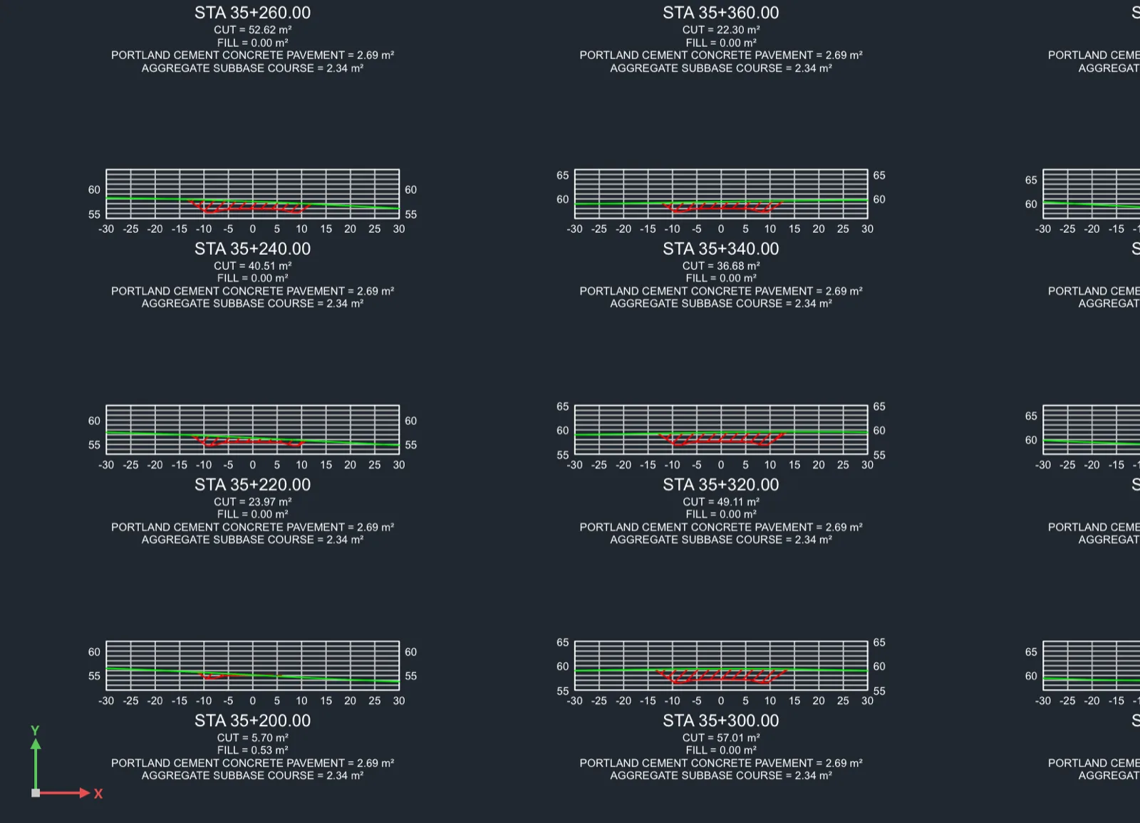
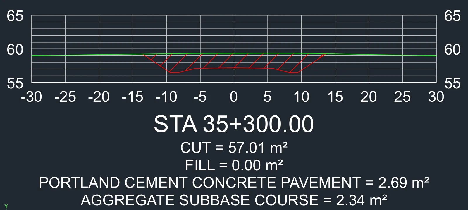
Each view has:
- a grid every 5 m across and 1 m up, offsets along the bottom (−30 to 30) and elevations on both sides;
- the existing ground (green) and the corridor (red), with the cut and fill areas hatched between the ground and the datum;
- under the view, the station (STA 35+300.00) and the area of every material: CUT, FILL, and the pavement layers.
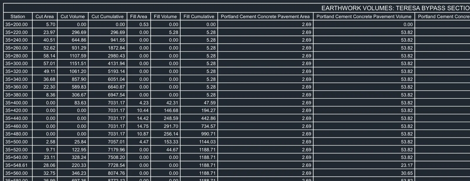
To the right of the views Terrace draws the earthwork volume table (a table entity on C-ROAD-SCTN-TABL): one row per sample line with each material's area, volume and cumulative volume, and the mass ordinate.
Hide or show the views and change their look in the group's Properties (below): Show section views, Views per column and Vertical exaggeration. To put the views on plot sheets, use SECTIONSHEETS (see Sheets and plotting).
Materials: cut, fill and pavement
A group measures materials. The first time it's computed, Terrace makes them for you:
- Cut: where the ground is above the corridor's datum (or top, if that's what the group samples);
- Fill: where the ground is below it;
- one material per pavement shape the corridor carries, named after its material: for a DPWH section, Portland Cement Concrete Pavement and Aggregate Subbase Course.
The volumes Terrace reports are geometric: cut is measured in its original position (bank volume) and fill as compacted in place, exactly as DPWH pays them. Shrinkage and bulking only change the mass haul, through the embankment factor you set with COMPUTEVOLUMES.
Computing volumes
Volumes are computed as soon as the sample lines exist; use COMPUTEVOLUMES to choose the method and the embankment factor, and to print the totals and the pay items.
- Click Roads ▸ Volumes (also on the Corridor tab), or type
COMPUTEVOLUMES(CVOLUMES, orEARTHWORK). - Select sample line group: Enter for the selected (or latest) group.
- Volume method [AverageEndArea/Prismoidal]: Enter keeps the group's method (average end area at first); type P for prismoidal, A for average end area.
- Embankment factor (cut needed per m³ of fill, e.g. 1.25): Enter keeps the current factor (1 at first), or type one.
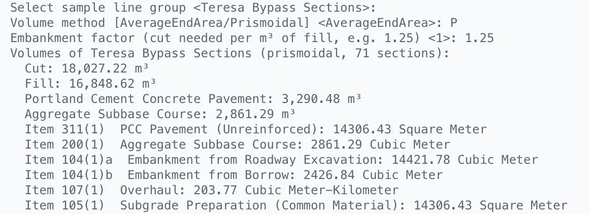
The two methods
- Average end area (the DPWH and textbook default): the volume between two lines is the average of their areas times the distance between them, V = (A₁ + A₂) / 2 × L.
- Prismoidal: V = L / 6 × (A₁ + 4 Am + A₂), where Am is the area of a section Terrace cuts halfway between the two lines. It's more exact where the ground changes quickly between lines; average end area tends to over-estimate there.
Distances are measured along the alignment (station equations don't break them). On sharp curves, turn on Curve correction in the group's Properties: each area is then corrected for the distance of its centroid from the centerline (the inside of a curve is shorter than the outside).
The embankment factor
Soil dug from a cut takes up a different volume once compacted in an embankment. The embankment factor says how many cubic metres of cut you need for one cubic metre of compacted fill: 1.25 means 1.25 m³ of cut per m³ of fill. It doesn't change the cut and fill volumes, only the mass haul — and through it the borrow, the waste and the embankment pay items.
Mass haul
The mass haul diagram answers: where does the cut go, how far, and how much material has to be brought in or thrown away? Its line is the mass ordinate, the running total of cut (times its factors) minus fill (times the embankment factor) from the start of the road. Where the line rises the road is in cut; where it falls, in fill. Wherever it crosses zero, cut and fill balance: material between two balance points can be moved from the cut to the fill without importing or exporting any.
- Click Roads ▸ Mass Haul, or type
MASSHAUL(MHAUL). - Select sample line group: Enter for the selected (or latest) group.
- Free haul distance: Enter for 600 m, the DPWH free haul (Item 107; 500 ft in US units), or type the contract's distance.
- Specify mass haul diagram origin: click where the diagram's lower-left corner goes.

MASSHAUL with the 600 m DPWH free haul (here after the 1.25 embankment factor above).Terrace works out, for each loop of the diagram between balance points:
- Free haul volume: material moved no farther than the free haul distance — included in the excavation and embankment prices.
- Overhaul volume: material moved farther than that. Terrace finds it the textbook way, by fitting a horizontal chord as long as the free haul distance inside the loop.
- Overhaul: the overhaul volume times the extra distance it travels (centroid to centroid, minus the free haul), in m³·m; DPWH pays it in m³·km under Item 107.
- Borrow and waste: what's left unbalanced at the end — material to bring in from a borrow pit, or surplus cut to dispose of.
The diagram is drawn with a grid of stations and volumes, the balance line, the mass line in blue (C-ROAD-MASS), a small circle and the station at each balance point, and three lines of totals under it.
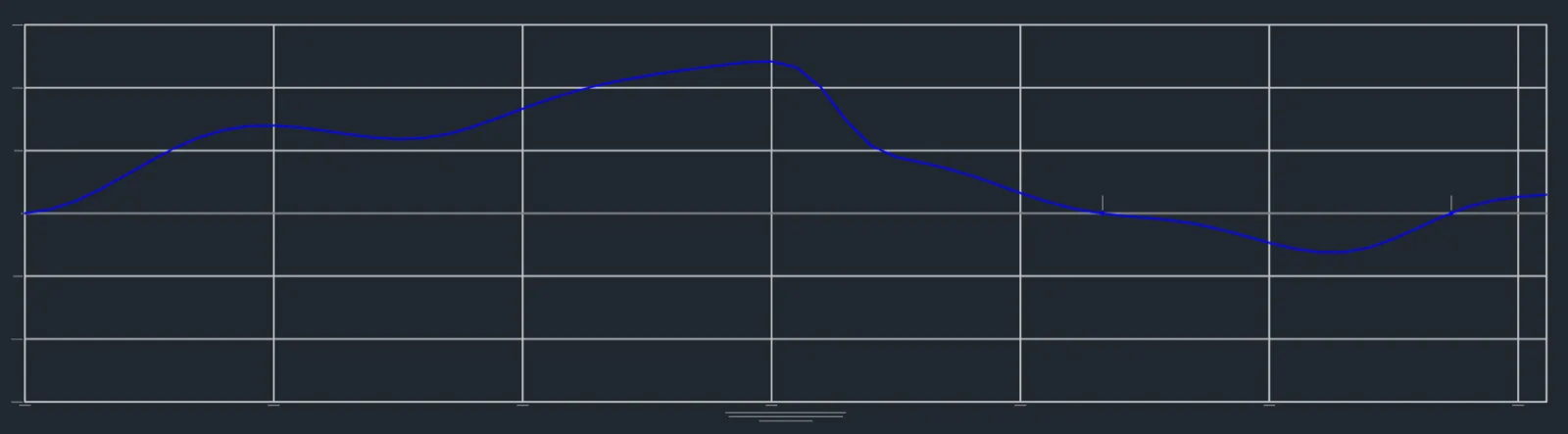

Change the free haul later in the group's Properties (Free haul distance); hide the diagram with Show mass haul.
Sample line group properties
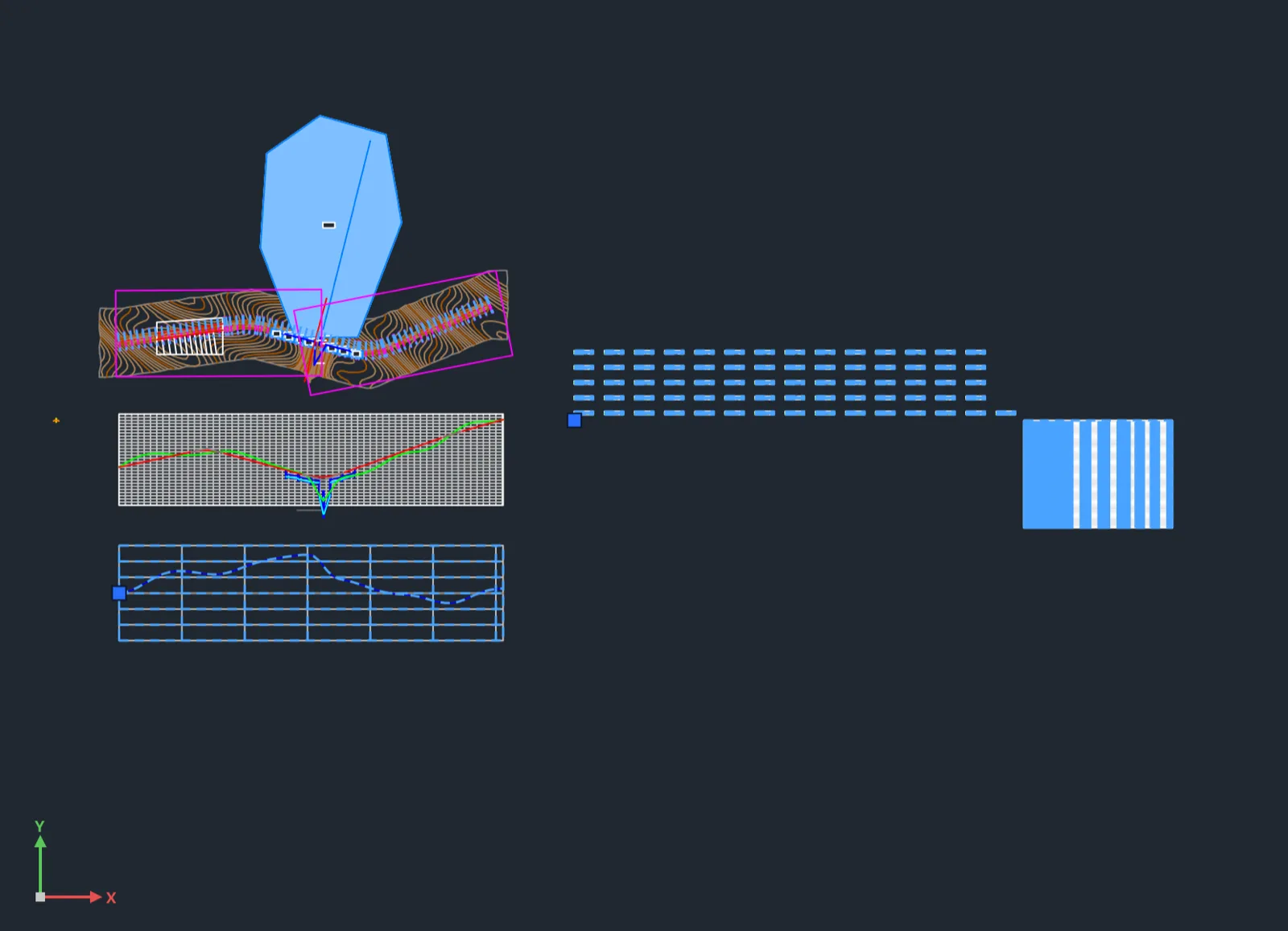
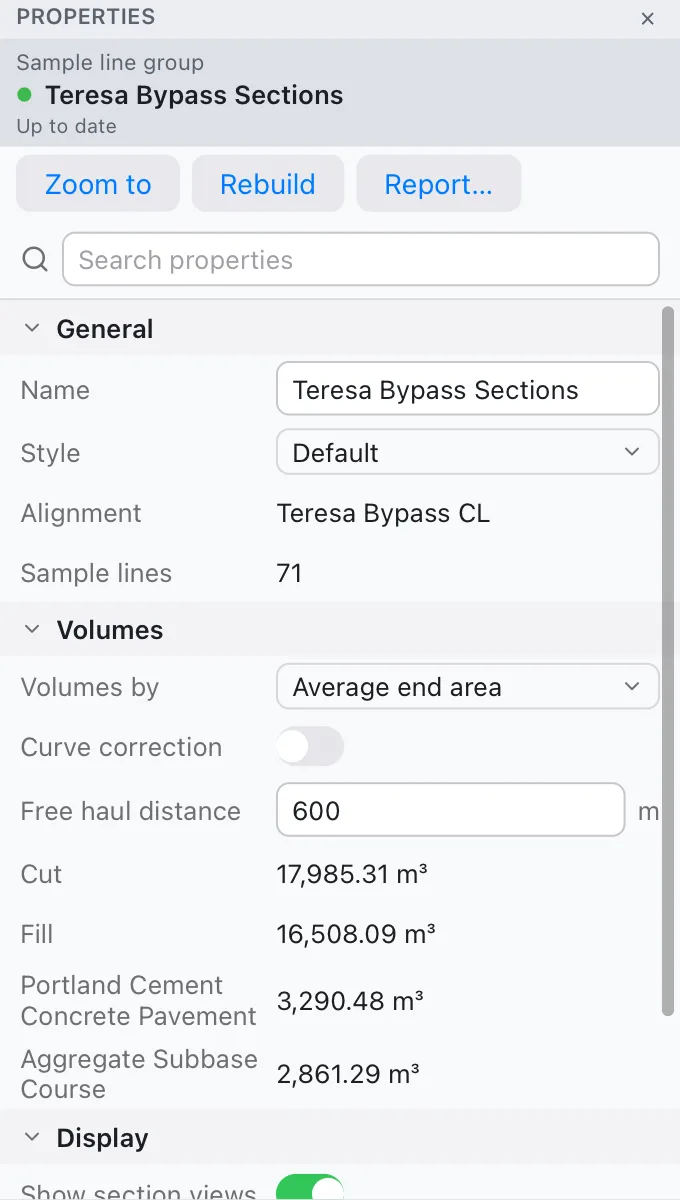
Select the group — click a sample line or its name in the Project browser. The plan highlights everything that belongs to it, and Properties shows its settings and totals.
| Row | What it does |
|---|---|
| Name, Style | The group's name and how its lines, views and diagram are drawn. |
| Alignment, Sample lines | The alignment it follows and how many lines it has (read only). |
| Volumes by | Average end area or Prismoidal. |
| Curve correction | Correct the areas on curves for their centroid's offset. |
| Free haul distance | The mass haul's free haul (600 m by default). |
| Material rows | The total volume of each material (read only). |
| Show section views, Views per column, Vertical exaggeration | Draw the views (and the volume table), how many per column, and how much to stretch them vertically. |
| Show mass haul | Draw the mass haul diagram. |
The embankment factor isn't in the panel: set it with COMPUTEVOLUMES.
DPWH pay items
Terrace turns the volumes into the pay items of the DPWH Standard Specifications for Highways, Bridges and Airports (2013, the "Blue Book"), Volume II, with the 104 (1) a / b split of DPWH Department Order No. 96, s. 2016. They're listed by COMPUTEVOLUMES and in the Quantity takeoff report.
| Pay item | Unit | How Terrace measures it |
|---|---|---|
| 102 (2) Surplus Common Excavation | m³ | Only the cut that isn't used in embankment: the mass haul's waste, in bank volume. (Cut that goes into the fills is paid under 104.) |
| 104 (1) a Embankment from Roadway Excavation | m³ | The fill, compacted in place, as far as the road's own cut covers it. |
| 104 (1) b Embankment from Borrow | m³ | The rest of the fill: the mass haul's borrow, in compacted volume. |
| 105 (1) Subgrade Preparation (Common Material) | m² | The plan width of the pavement structure times its length. |
| 107 (1) Overhaul | m³·km | The mass haul's overhaul beyond the free haul distance (600 m). |
| 200 (1) Aggregate Subbase Course | m³ | The subbase shapes' volume, compacted in place. |
| 201 (1) Aggregate Base Course | m³ | The base shapes' volume (on sections with a base course, such as AASHTO's). |
| 310 (1) Bituminous Concrete Surface Course, Hot-Laid | m² | The asphalt layer's plan area. |
| 311 (1) PCC Pavement (Unreinforced) | m² | The concrete pavement's plan area. |
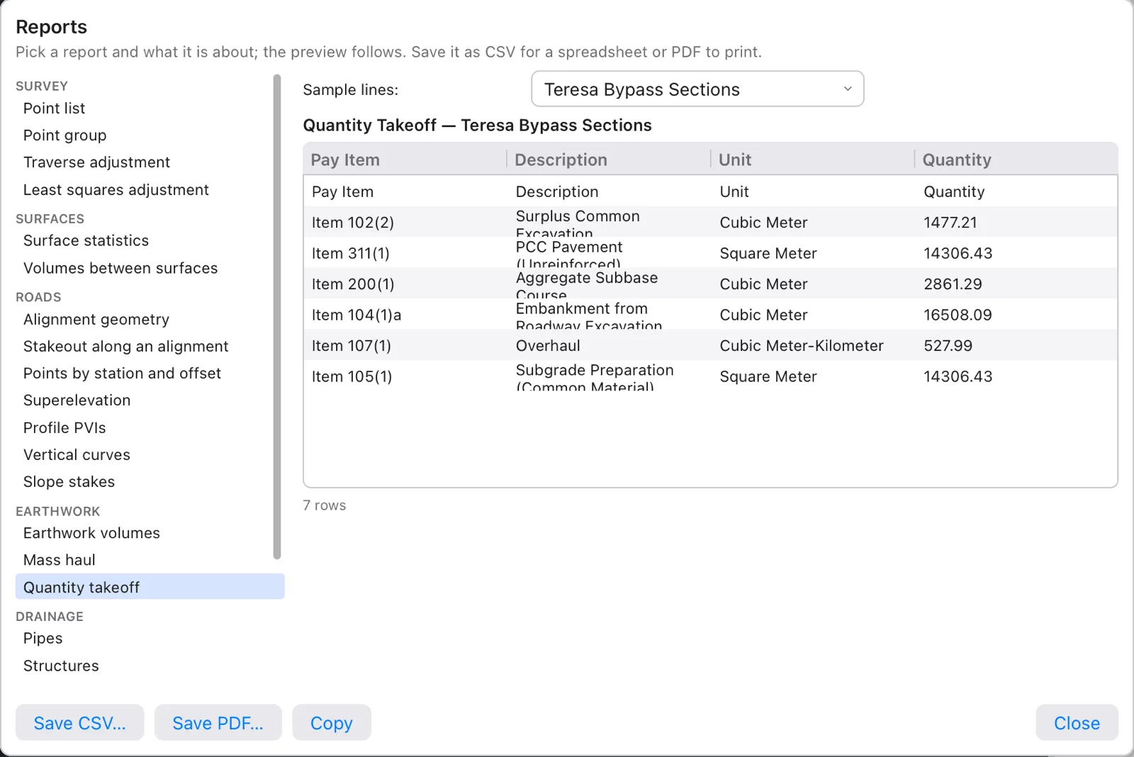
On the sample road (average end area, factor 1) the takeoff is 1,477.21 m³ of Item 102 (2), 16,508.09 m³ of 104 (1) a, 527.99 m³·km of 107 (1), 2,861.29 m³ of 200 (1), and 14,306.43 m² each of 311 (1) and 105 (1) — the 11.70 m of PCCP lanes and shoulders over 1,222.77 m.
Note The materials, their factors and their pay items are made by Terrace and can't be edited in this version; only the embankment factor can be set.
Earthwork, mass haul and quantity takeoff reports
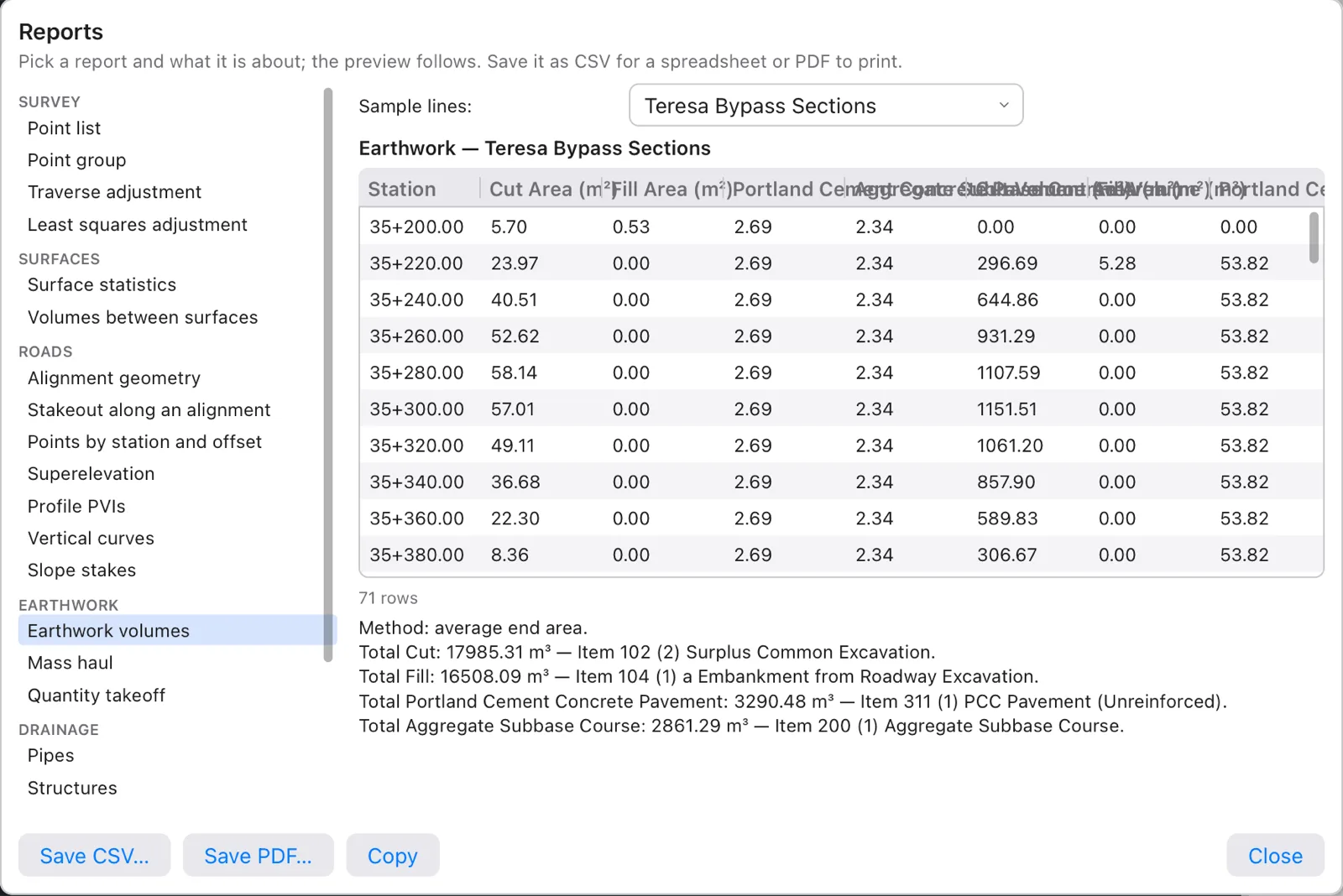
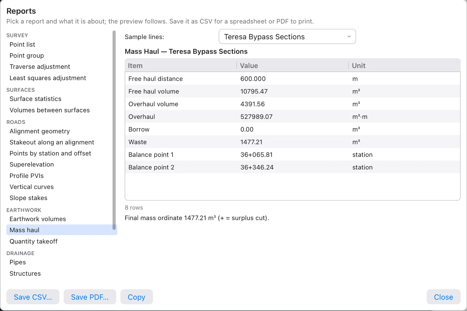
Three reports cover earthwork. Select the group and click Report… in Properties: the Reports dialog opens on Earthwork volumes; click Mass haul or Quantity takeoff in its list for the others. You can also type EARTHWORKREPORT (VOLREPORT, also Sheets ▸ Earthwork), which asks for the group, prints the report in the command history and opens the dialog. Each report saves as CSV or PDF, or copies to the clipboard (see Reports).
Earthwork volumes
One row per sample line: the station, then each material's area, volume since the previous line, and cumulative volume, and the mass ordinate. Under the table: the method, and each material's total with its pay item.
Mass haul
The free haul distance, free haul volume, overhaul volume, overhaul (m³·m), borrow, waste and the station of every balance point; the final mass ordinate is under the table (+ means surplus cut).
Quantity takeoff
Pay item, description, unit and quantity, as in the table above. For a corridor instead of a sample line group, the report lists the volume of each pavement material from the corridor's shapes.